
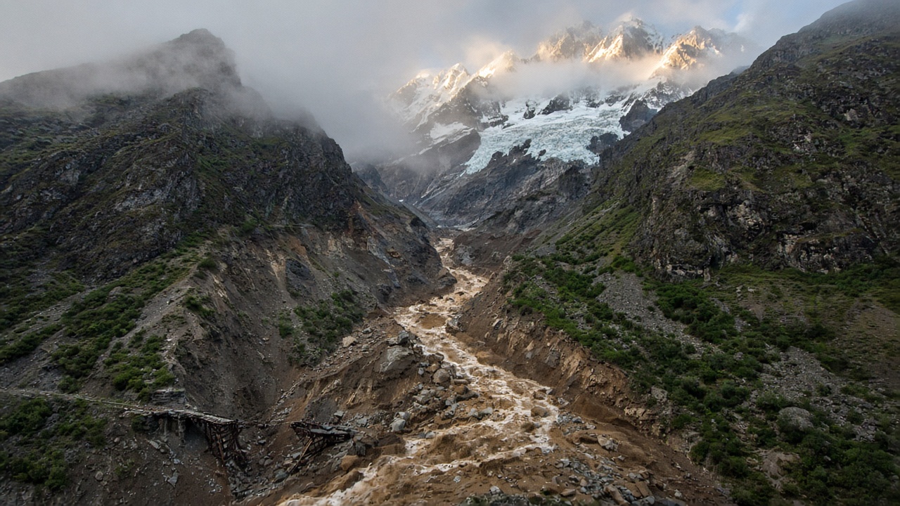
After several days of heavy rain, people in Japan have once again been watching rivers rise and hillsides give way. Similar images appeared in August 2026 after a disaster struck the border between Nepal and Tibet. However, this was not an ordinary rain-triggered landslide. Surveillance footage showed hundreds of people running as a huge wall of water, mud, ice, and rock rushed toward them.
数日間の大雨のあと、日本の人々は再び川の水位が上がり、斜面が崩れる様子を見守っています。似た映像は、2026年8月にネパールとチベットの国境で災害が起きたあとにも現れました。しかしこれは、普通の雨による土砂崩れではありませんでした。監視映像は、水、泥、氷、岩の巨大な壁が向かってくるなか、何百人もの人々が走る様子を映していました。
The disaster began near Langtang Lirung, a mountain in the Himalayas. The violent flow swept through communities, roads, bridges, and a busy border crossing. It continued for dozens of kilometres along the river system. More than 1,400 people were later reported dead, while thousands remained unaccounted for. The missing included local residents, workers, tourists, and pilgrims travelling toward Mount Kailash.
災害は、ヒマラヤの山であるランタン・リルンの近くで始まりました。激しい流れは共同体、道路、橋、そして忙しい国境通過点を襲いました。それは河川系に沿って何十キロも続きました。その後、1,400人以上が死亡したと報じられ、何千人もが行方不明のままでした。行方不明者には地元住民、労働者、観光客、カイラス山へ向かう巡礼者が含まれていました。
At first, the cause was unclear. Nepal’s foreign minister suggested that an earthquake might have triggered the flooding. Instruments had recorded a powerful seismic signal, and this appeared to support the idea. Scientists studying the waves, however, noticed that they did not have the usual pattern of an earthquake. The ground had shaken, but something else had produced the energy.
最初、原因は不明でした。ネパールの外相は、地震が洪水を引き起こしたかもしれないと示唆しました。計器は強い地震信号を記録しており、これはその考えを支えるように見えました。しかし波を調べた科学者たちは、それが通常の地震のパターンを持っていないことに気づきました。地面は揺れていましたが、エネルギーを生み出したのは別のものでした。
Satellite images revealed the more likely explanation. A huge mass of rock and glacier ice had broken away high on the mountain. It fell more than a kilometre into the valley below and hit the ground with enormous force. That impact created the signal recorded by earthquake instruments. The falling material then cascaded down the steep valley, gathering more rock, soil, ice, and water as it moved.
衛星画像が、よりありそうな説明を明らかにしました。岩と氷河の氷の巨大な塊が、山の高いところで剥がれ落ちていました。それは下の谷へ1キロ以上落ち、巨大な力で地面にぶつかりました。その衝撃が、地震計が記録した信号を作りました。落ちた物質はその後、急な谷を流れ落ち、動きながらさらに岩、土、氷、水を集めました。
Scientists are still investigating where all the water came from. Friction may have melted part of the falling ice. The material may also have temporarily blocked a river, allowing water to collect before the natural barrier broke. Whatever the exact sequence, the result was a massive debris flow that travelled rapidly downstream. What looked like one event was actually a chain of connected events.
科学者はいまも、すべての水がどこから来たのかを調べています。摩擦が落ちる氷の一部を溶かしたのかもしれません。物質が一時的に川を塞ぎ、自然の障壁が壊れる前に水がたまったのかもしれません。正確な順序が何であれ、結果は下流へ急速に進んだ巨大な土石流でした。一つの出来事のように見えたものは、実際にはつながった一連の出来事でした。
The same chain made the rescue operation extremely difficult. Roads and bridges disappeared, communications failed, and some villages were completely cut off. Helicopters became essential, but finding safe landing places in a high mountain region was difficult. Rescue workers were therefore facing two problems at once: reaching survivors and operating in an area that could remain unstable.
同じ連鎖が、救助活動を極めて難しくしました。道路と橋は消え、通信は途絶え、一部の村は完全に遮断されました。ヘリコプターが不可欠になりましたが、高い山岳地域で安全な着陸場所を見つけるのは困難でした。したがって救助隊員は同時に二つの問題に直面していました。生存者に到達することと、不安定なままになりうる地域で活動することです。
Japan’s recent landslides usually begin differently. Heavy rain enters the soil and weakens steep slopes, while the Nepal disaster began high in the mountains with a collapse of rock and glacier ice. Yet both show how quickly one failure can produce several others. A slope collapses, a road disappears, a river changes direction, and a community loses its escape route. Understanding such disasters requires us to study the entire chain—not only the first thing that went wrong.
日本の最近の土砂崩れは通常、違う始まり方をします。大雨が土に入り急斜面を弱めるのに対し、ネパールの災害は山の高いところで岩と氷河の崩壊から始まりました。しかしどちらも、一つの失敗がいかにすばやく他のいくつかを生みうるかを示しています。斜面が崩れ、道路が消え、川が向きを変え、共同体が逃げ道を失います。そのような災害を理解するには、最初にうまくいかなかったことだけでなく、連鎖全体を調べる必要があります。